(To play the video, please click on the image above)
Photo: Northern lights, Aurora Borealis (photo: pixabay)
(To play the video, please click on the image above)
Photo: Northern lights, Aurora Borealis (photo: pixabay)
Earth magnetism is not only crucial for life on Earth: it has a very special meaning for plate tectonics, because magnetic information can be stored in rocks and in this way the former positions of plates on the Earth’s body and the age of the oceanic crust can be determined.
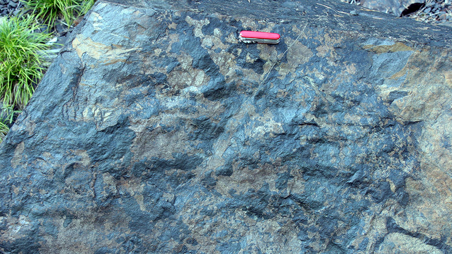
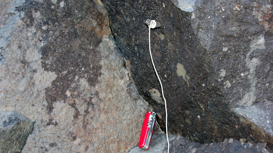
Fig. 3.7.1, a: Magnetite, mineral with a high iron content; b: Magnet attached to magnetite (photos: Meschede, 2008, Sweden)
The storage of magnetic information is possible because the rocks contain magnetizable minerals with a high iron content: magnetite, hematite, pyrrhotite and many others (Fig. 3.7.1a, b).


Fig. 3.7.2, a: Magnetic hard drive storage of a modern computer (photo: pixabay), b: Audio tape cassette from the 80s of the last century (photo: Meschede, 2022).
These minerals can store the magnetic information that is imprinted on them under certain conditions, similar to magnetic hard drives in modern computers or tape recorders of the 80s and 90s of the last century (Fig. 3.7.2a, b).
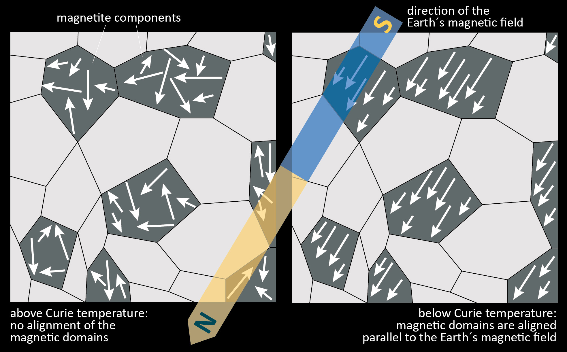
Fig. 3.7.3: Alignment of magnetic domains according to an applied magnetic field (Meschede, unpubl., 2022)
Basaltic rocks formed at a spreading center from an igneous melt contain a lot of magnetite, which can store the orientation and intensity of the Earth’s magnetic field at the time of formation (Fig. 3.7.3). The minerals store the magnetic information a short time after their formation, namely then, when they cool below a certain temperature. This temperature, which can be between 580 and 650°C in rocks of the oceanic crust depending on the mineral, is called the Curie temperature, named after the famous physicist and Nobel Prize winner Pierre Curie (1859-1906). Above this temperature, the magnetization is unstable and is not stored; below, however, the information from the current magnetic field is retained, even if the Earth’s magnetic field continues to affect the rock later.
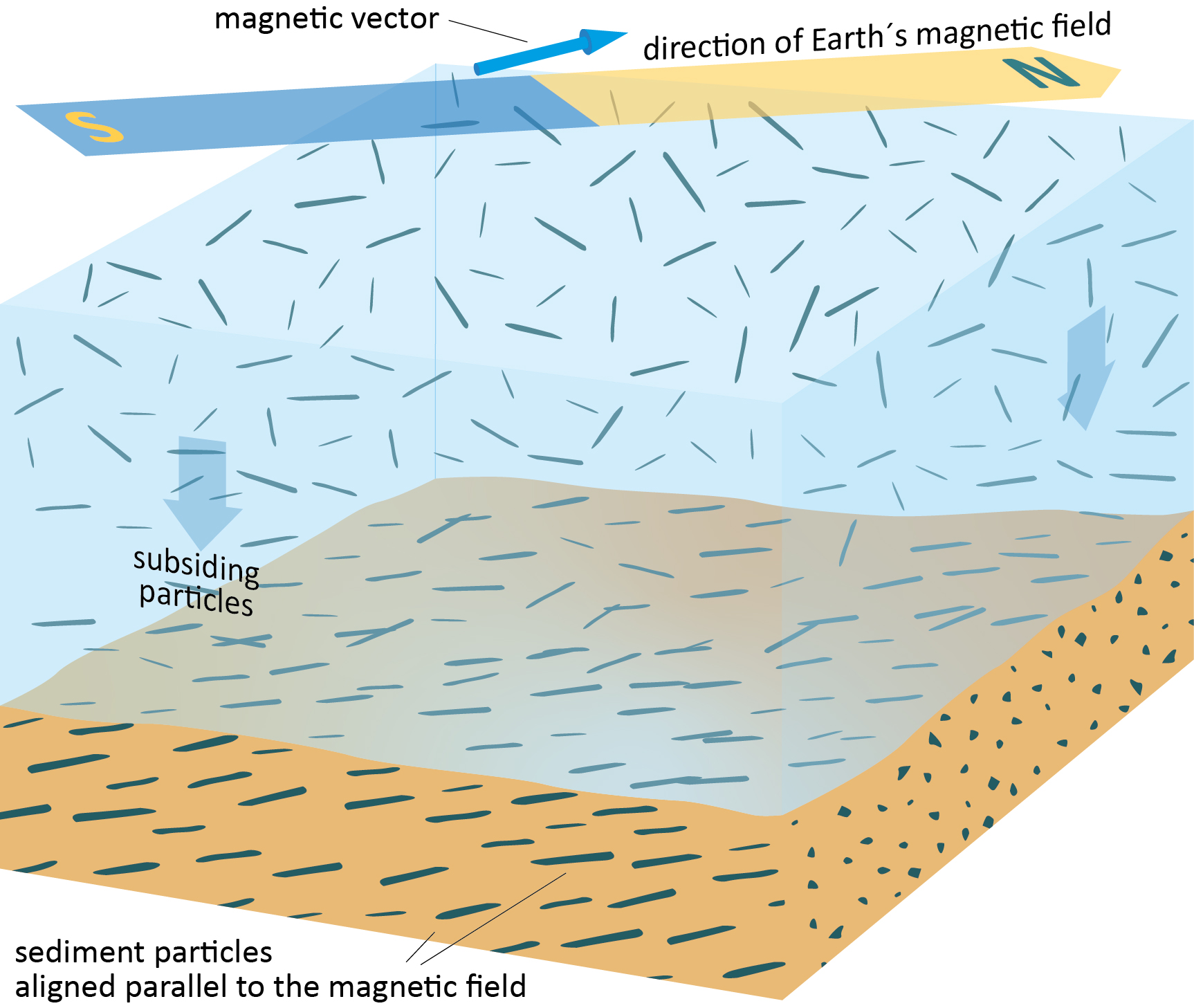
Fig. 3.7.4: Alignment of magnetizable particles while sinking during sedimentation (Meschede, unpubl., 2022)
Even very fine-grained sedimentary rocks can store magnetic information, but this is not caused by the cooling of the minerals below the Curie temperature. During sedimentation, the fine particles slowly sink to the seafloor, whereby elongated magnetic minerals are aligned parallel to the Earth’s magnetic field and embedded in the sediment (Fig. 3.7.4). The magnetization is much weaker than in the newly formed rocks of the oceanic crust, but with modern magnetometers it is now possible to read even this weak magnetic information.
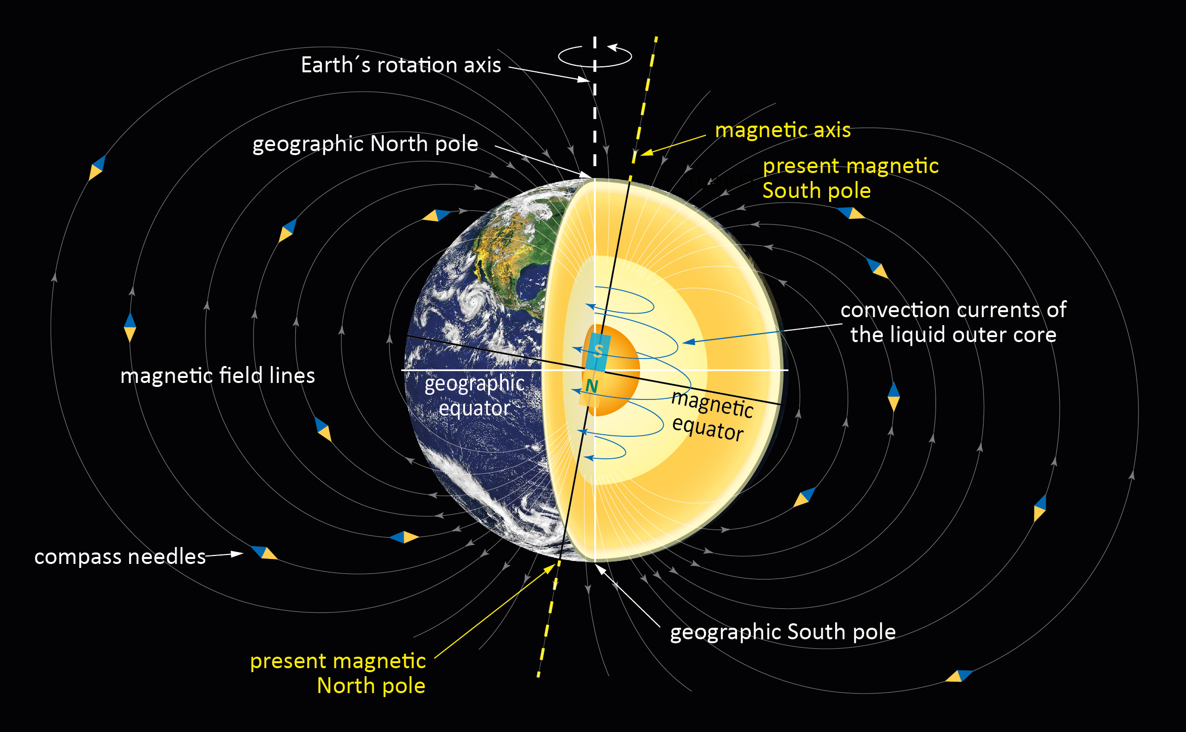
Fig. 3.7.5: The Earth’s magnetic field (Meschede, unpubl., 2022, satellite image: pixabay)
Today it is assumed that the Earth’s magnetic field is essentially created by strong currents in the liquid outer core of the Earth (Fig. 3.7.5). The Earth’s core consists largely of iron, which is why it acts like a huge bar magnet around which the magnetic field develops. This magnetic field is usually represented by the magnetic field lines, whereby the field lines are directional, i.e. the lines always run out of the magnetic north pole and back into the magnetic south pole. They are therefore a directional quantity and can be described as a magnetic vector.
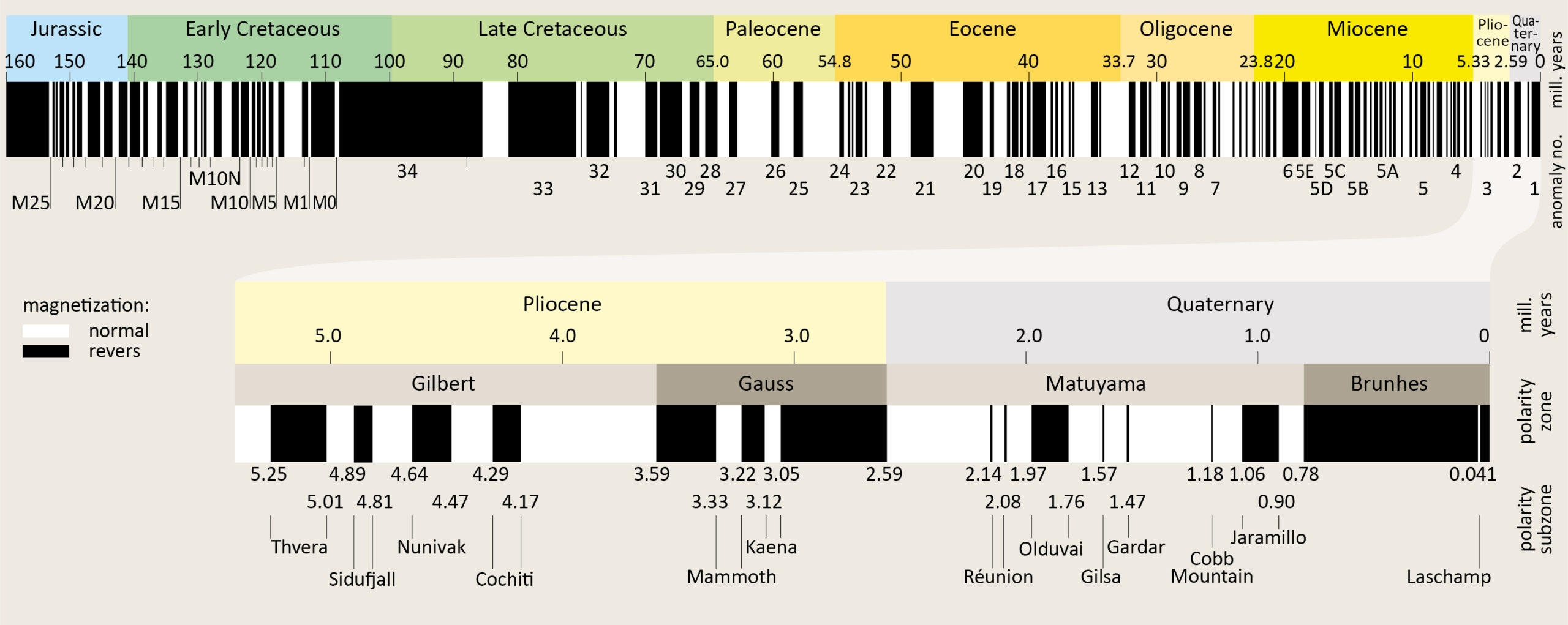
Fig. 3.7.6: Magnetostratigraphic time scale with the polarity reversals of the Earth’s magnetic field (modified from Meschede, 2021; after Ogg et al., 2016, USGS Geol. Survey, 2007)
The magnetic north pole is today close to the geographic south pole, a fact that is often not accurately represented in textbooks and illustrations on the Internet. The polarity of the Earth’s magnetic field has repeatedly reversed over the course of Earth’s history, sometimes at short intervals, sometimes at longer intervals, as can be seen in the magnetostratigraphic time scale in Fig. 3.7.5. There have been around 70 polarity reversals in the last 40 million years alone. But there are also quiet phases, such as in the Cretaceous period, where there was no polarity reversal at all over a period of 20 million years. The polarity reversals are of great importance for the detection of plate tectonic movements, as they create the magnetic stripe patterns on both sides of the spreading zones.
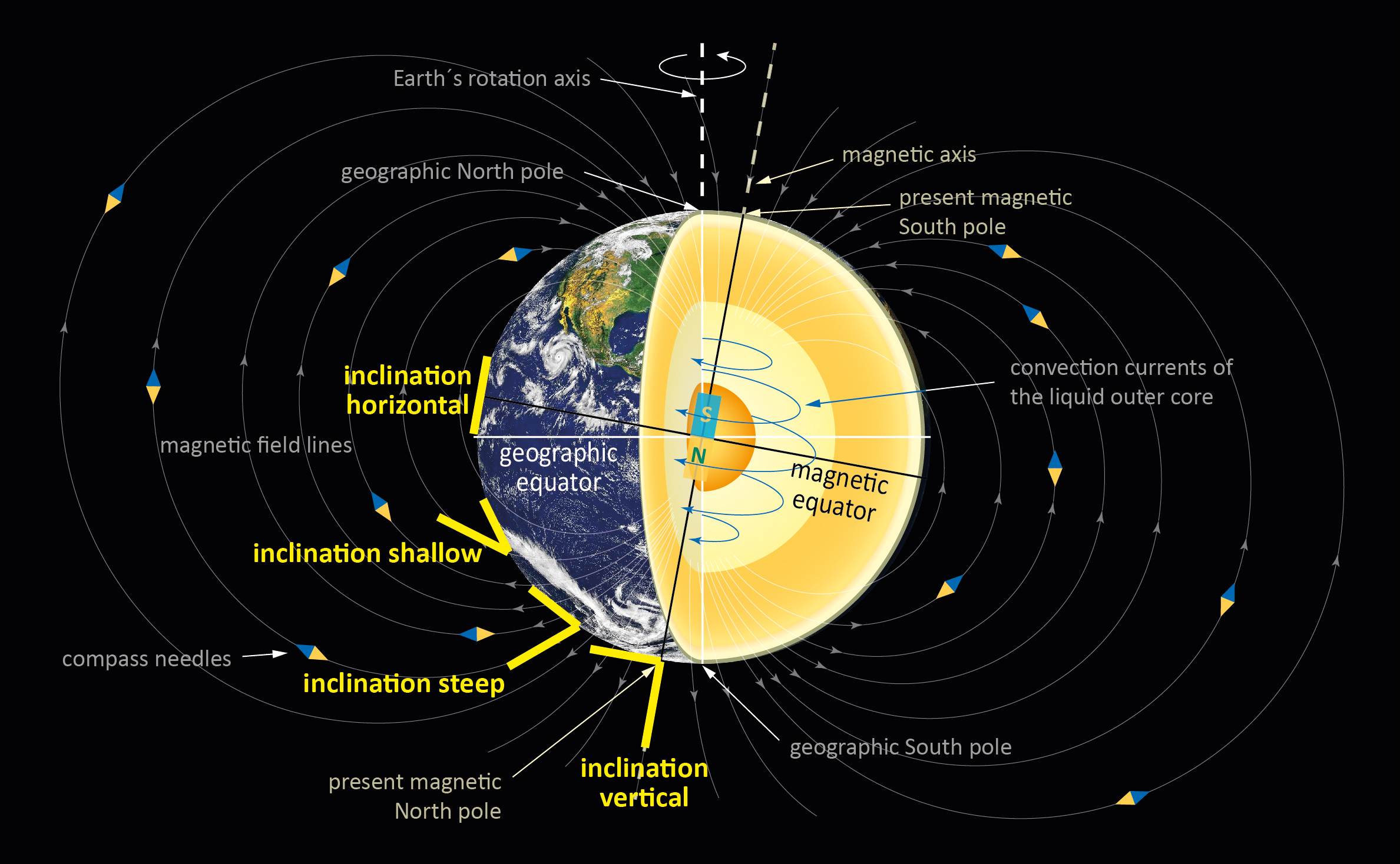
Fig. 3.7.7: Inclination of the magnetic field lines from the equator to the poles (Meschede, unpubl., 2022)
Plate tectonic transformations over time can be determined by the inclination and declination of the magnetic vector. Inclination indicates the angle at which a magnetic vector is inclined to the Earth’s surface, and its deviation from the current geographical north direction determines the declination.
If the magnetic information was not erased by heating above the Curie temperature, the inclination of the magnetic vector can be used to roughly determine the latitude at which the examined rock was located at the time of its formation. This is possible because it can be assumed that the magnetic poles – regardless of their polarity – were always at least close to the geographical poles. Since the inclination of the magnetic vector is 90° at the pole and 0° at the equator (Fig. 3.5.7) and changes systematically in between, the paleolatitude can be determined mathematically. Plate tectonic shifts in the north-south direction can be determined if you know how old the rocks being examined are, but this does not work in the east-west direction since the longitude cannot be measured. The zero meridian is not a natural entity and was determined arbitrarily by humans.
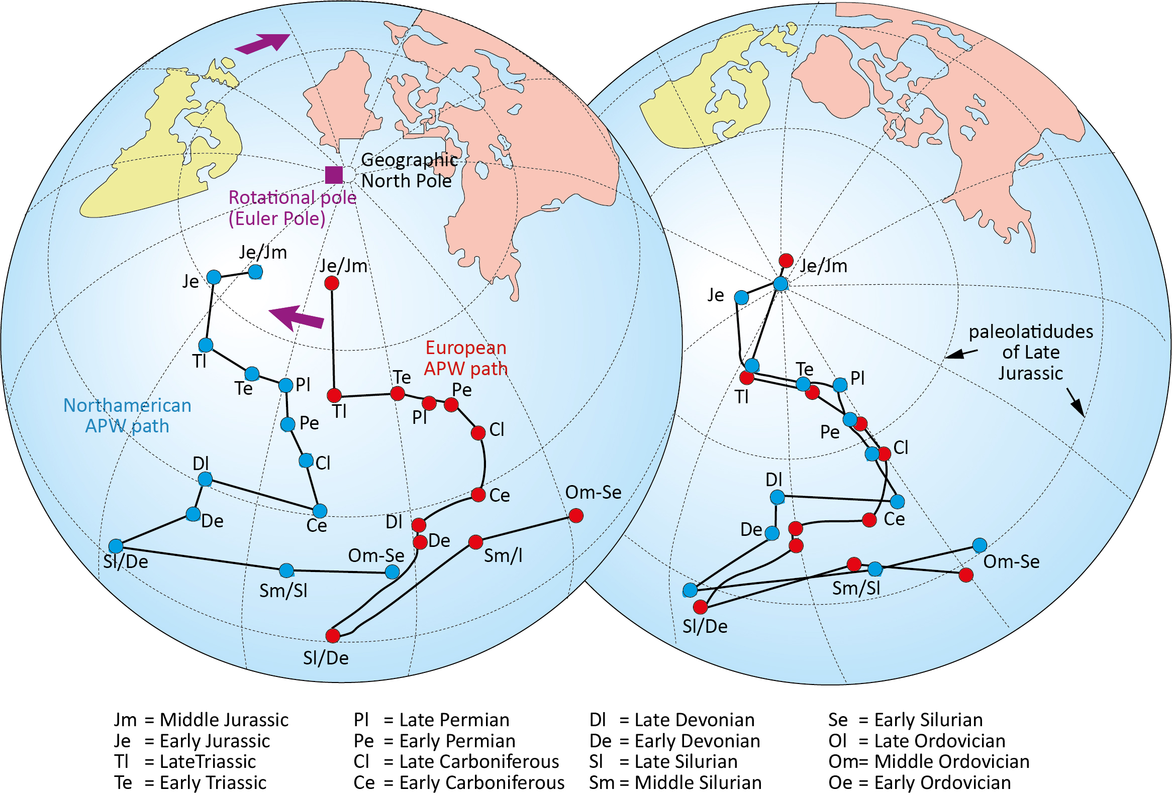
Fig. 3.7.8: Apparaent Polar wander paths (APWP) for North America and Europe (Meschede, unpubl., 2007, modified after Lowrie, 1997)
Using inclination and declination, the position of the pole at that time can be calculated from magnetic data of the same age that were measured at different locations on the same tectonic plate. However, since the plate has moved since the magnetic information was imprinted, the pole position determined in this way no longer corresponds to the current pole position, i.e. the pole has apparently moved with respect to today’s pole position – although of course it was also at the geographical north pole at the time of imprinting but because the plate drifted away and rotated, the pole that was calculated apparently moved. If you calculate the pole positions for magnetic data of different ages, the apparent polar wander path (APWP) results. In reality, it is the plate that moves, but it takes the information about the pole position with it. When such studies are carried out in Europe and North America, for example, it can be seen that the polar wander paths are similar, but are still far apart. However, when the continents are moved back to their position before they drifted apart, the curves overlap almost identically. This agreement is viewed as evidence for the existence of plate drift.


![]()
©2022 Deutsche Geologische Gesellschaft - Geologische Vereinigung